

The three miles of twisting road from Three Rivers to the National Park follows the river. Walls of rock jut out toward the road. A bridge built in 1922 crosses the river.


From there the road steadily climbs toward the National Park.


At the park gate we approached the auxiliary booth. We couldn't use the main lane because a motorhome was crammed between the office building and the auxiliary booth. The RV's bedroom slide hung off the top of the auxiliary booth. The back of the RV extended about 6 feet away from the chassis. We don't know if the slide came open on its own, or if it caught on the booth eave. Either way as the driver accelerated to leave the booth, the entire slide was peeled open as if by a can opener. The bedroom interior became fully exposed. We were told the rig had been stuck about 1 1/2 hours already waiting for a tow truck. When we completed our short visit to the park and were exiting the park, the RV was still waiting. By that time he had waited at least 3 hours.


 The road continues to wind upward. Mountains rise high on either side of the river valley. Some peaks even have a trace of snow on them.


Pull-outs allow visitors spectacular views of white water rapids tumbling over large boulders in the river's path.


We stopped at the Foothills Visitor Center to get beginning information on the park. We only received minimal information here.

We left the visitor center and headed up the road. Tunnel Rock is listed as one of the park attractions. We've seen many such balancing rocks in our travels. This is more of a photo op place for park visitors.

Our first real stop was the Hospital Rock Picnic Area. The Western Mono people once inhabited this particular area. Exhibits tell their story. A trail from the parking lot leads kayakers down to a launching area and the cascades for white water rafting.
 Across the road a "native kitchen" shows a big rock with lots of can size holes randomly placed in it. A reader board describes how the kitchen was used.
The women pounded acorns into flour in the holes, and then make soups and mush.


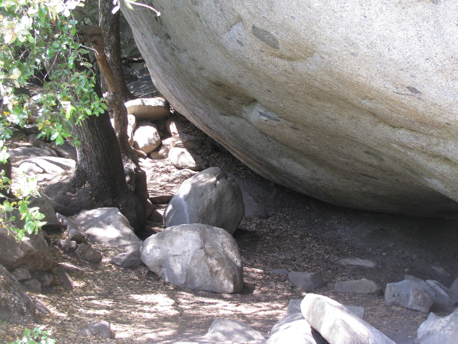
The huge rounded boulder called Hospital Rock provides cool relief from the heat of summer in the small cave-like area on its underside and tall vegetation on the outskirts. In winter a fire could be built in this area to provide warmth. Hospital Rock...a place for healing.
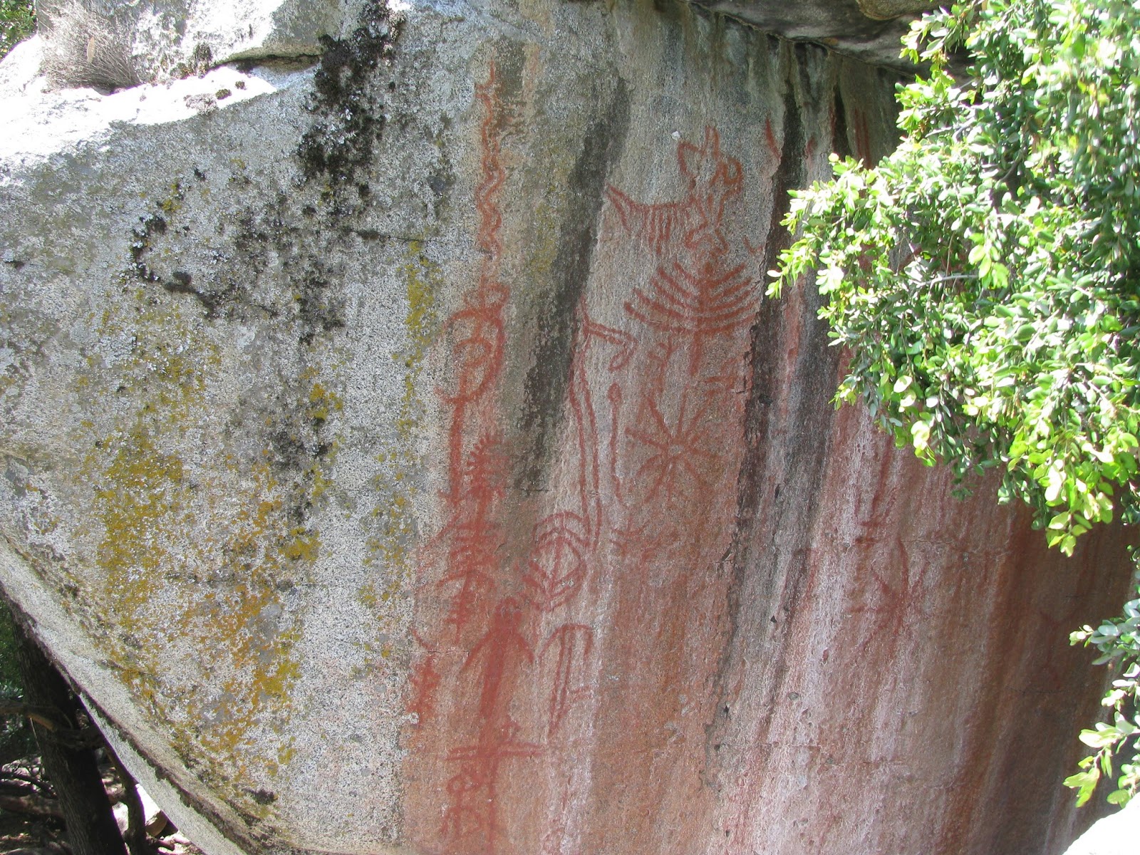


Petroglyphs fill one side of Hospital Rock. We always find petroglyphs interesting.


From here the road rises in a series of hairpin curves. 10 MPH signs appear at a multitude of curves.

The Yucca plants were in bloom all over the park.

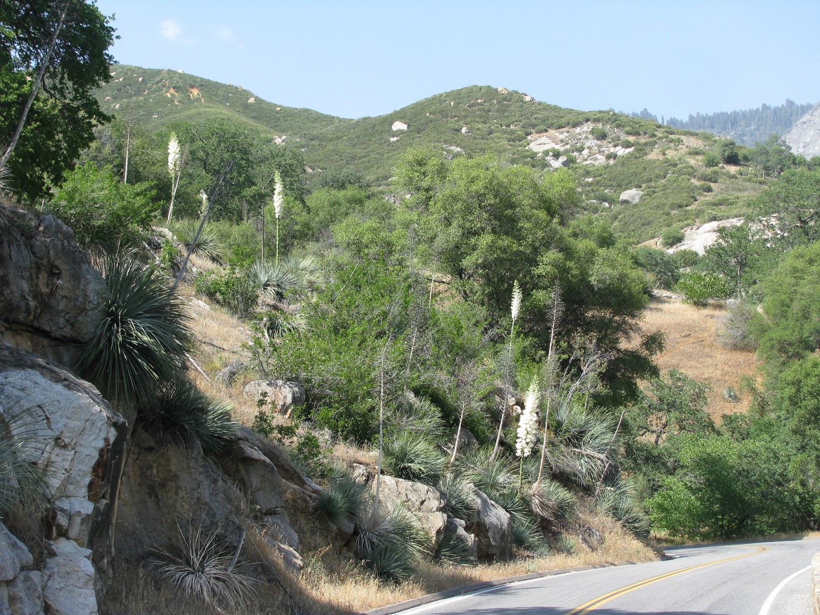
Sometimes we saw just one or two, and sometimes yucca blooms filled a whole hillside.


Just past the 4000 foot elevation sign a bright orange ROAD WORK warning looms out from the shoulder. The flagman caught my eye as a photo op. He informed us that we just missed the road opening...which explains why we were now first in line at 3:10 pm. The road opens for uphill traffic every hour on the hour. The next opening would be 4:00 pm. We opted not to wait since it was so late in the day. So we turned around and headed back down the mountain. From this point to the park entrance took 45 minutes to drive down. Then we needed another 15 minutes to return to the RV. We will return the park tomorrow.
No comments:
Post a Comment