Wednesday, October 31, 2012
The Grapevine to Rancho CA
We spent Sunday night in the Flying J truck stop at Frazier Park. We’ve borrowed their parking lot on several occasions. Sleeping in a truck stop comes with the expectation of noise. However, much to our surprise that night produced very little noise, unlike the RV Park in Lodi. In Lodi the noise from I-5, Hwy 99 and the road that connects those two freeways reverberated all night.
The grapevine affectionately or not so affectionately refers to the I-5 passageway through the mountains. I believe the tiny town of Grapevine once sat at the northern base on the flats. The town of Lebec rises about 9 miles up from the base. Frazier Park is a few miles further. The town of Castaic and larger town of Santa Clarita greet travelers at the southern base.
Trucks and RVs ascend the passes in long slow and tedious lines. Highways for northbound and southbound transverse separate parts of the pass coming together again at the north and south bases. The California speed limit for trucks and RVs remains at 55 MPH. The right lane is reserved for those vehicles with heavy loads or need to move at slower speeds. That lane may crawl up the hill at 25 MPH. Drivers must pay attention when passing the slower vehicles and maintaining their speed and momentum.
On Monday we waited for the going to work traffic to subside before starting out. Our plan worked. Only moderate traffic traveled with us. The map shows the grapevine hills to be part of the Angeles National Forest. That thought always makes me chuckle as I look at the barren hills with scrub oak and the occasional stunted growth trees.
Cuts made by erosion have created deep crevices between the mounds. The road climbs to a 3000 foot summit.
Steep downgrades signs and check your brake signs appear. The road moves down hill for a little ways, then it begins to climb again. The highest summit signs labels the elevation as over 4000 feet.
Along the way, in the middle of nearly barren hills sits the Pyramid Lake Recreation Area. Dams form the large, blue lake nestled among the hills. Signs indicate an RV park, but we never take the time to stop and explore the information center or park.
At this point the downward trek begins. The 10-11 miles of downgrade brings you into Castaic. Industrial buildings come into view. Off to the right the northbound traffic prepares for their ascent. The road flattens out. Wouldn’t you know one the first sights here are the Golden Arches of McDonald’s?
The roadway gets so much use that the surface is rough and battered.
Further south we pass Valencia CA, home to Magic Mountain Theme Park. Then we travel on to Santa Clarita. When driving to San Diego, Santa Clarita is where I start praying for safe travel through LA. Today we turn east onto I-210 across the top of the LA metro area.
The freeway lanes here constantly increase and decrease depending on the number of merging lanes. Drivers must be watchful as cars move on and off the highway.
You know you are in Southern California when:
...houses appear on hilltops.
... shopping centers offer low profiles with flat roofs, and Spanish architecture.
...business buildings have lots of glass and stucco
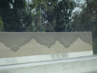
...freeway walls have interesting decorations
...houses peek out above the freeway walls and neighborhoods fill the land from the freeway to the distant hills.
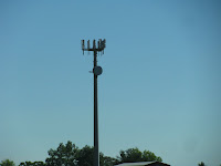
....cell towers stand out in close proximity to each other. Some are just towers and other may be disguised as a palm.
...freeways move traffic in all directions at once.
...HOV lanes have double yellow lines for miles..to stop moving in and out of regular traffic.
...rapid transit stations move people by rail.
...and two days before Halloween is still warm enough to travel with the top down and see purple flowers next to the road.
We exit to I-15 and drive south through the Cleveland Nat’l forest to the town of Temecula. Aware that Hwy. 79 offers a northbound exit as well as a southbound exit, we take the southbound exit which really heads east and then south. Shopping centers bump into each other on the road east.
The centers come to an abrupt end. Vegetation becomes sparse and dry. Desert areas begin.
The further we drive the more barren the hillsides.
Then humongous boulders come into view. The hills on I-8 have similar rock.
Then the minor highway narrows to just a country road that winds through rock littered hills. Ranches with gated entries and cute names began to show up. We pass the blink of an eye town of Aguanga. I think I saw three structures. Around one corner a lush green grass and vegetation announce the entry to Rancho California, our destination.
A narrow road lined with small trees leads us to the gate. We check in. The temperature is 84 degrees. Our friends, Nancy and Paul have site 301. We were fortunate to secure site 300 next door. These sites sit on a hill overlooking the resort.
Off to the right of our coach, we have a view of the fishing pond below with its 6 spouting jet fountains, ducks and paddle boats. Straight ahead we view a canopy of deciduous trees with some pine and lots of palms that provide some sun protection for the RV’s parked below them. Beyond the various lush green, the rock littered hills with scrub vegetation stand as a guardian for the resort nestled at its feet.
Our site reminds me of an exclamation mark in shape. On the outer edge of the site evenly spaced palm trees provide some shade while not interfering very much with the view. A circle of concrete with a central pit extends to the front and side of the coach. Six patio chairs sit around the smaller pit.
Thick green grass fills the area between the concrete and the edge of the hillside. What a lovely site! The atmosphere encourages relaxation.
Our second day here we drove around the 600 site resort. Each site retains private ownership, and reminds us of our stay at Key West. Different owners enhance their sites in different ways. Some build cabanas of wood, brick or adobe. The cabanas may be a full kitchen and/or bar. Some include couches and conversation areas.
The U-shaped cabana in Nancy and Paul’s site includes a big stainless steel BBQ with four control knobs, 2 refrigerators, a stove, 2 sinks, a garbage disposal, and lots of drawers. Four bar chairs slide under the eating bar at each outside end, and another two fit on the small additional section across the open side of the U.
Some of these structures include tables and chairs, a separate bar, and even washer and dryers. We found some to look awesome and others to look cluttered.
The golf carts tend to look alike except for color and whether they sit two or four.
This resort offers 5 swimming pools, the fishing pond and other bodies of water that serve as water hazards for the golf course that intertwines among the RV sites. The little store offers an interesting supply of food and dry goods. A small café with indoor and outdoor seating offers service at certain times of day.
This really is quite a place! For us the biggest negative remains the distance from here to the nearest stores and restaurants. An extended stay here would need trips into town to stock up. I would also have to watch the temperature. The high desert temps and I don’t exactly get along. Of course we have AC running from noon until about 6 pm when the sun goes down and the temperatures take a significant drop.
We shared a couple of lovely dinners with Nancy and Paul and enjoyed their company. We hadn’t seen them since last spring in Chula Vista.
Peugeot, their big white Great Pyrenees, seemed glad to see us too. I don't think his feline buddy, Braveheart cared one way or another.
We will think about returning here in the spring.
Subscribe to:
Comments (Atom)


